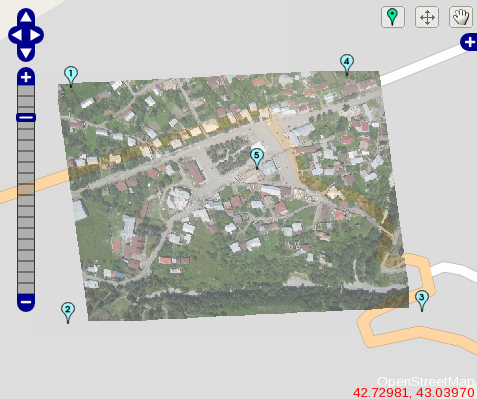
I’ve been banging my head against a wall for a few days on this one, first struggling with ImageMagick, then switching to gdal to get full-resolution geoTIFFs from Cartagen Knitter. I had a ‘duh’ moment just now when I realized that gdalwarp can only do polynomial or thin plate spline warps, neither of which are what I want – that is, perspectival warping. I want to map 4 corner ground control points or GCPs to four latitude/longitude positions. Back to ImageMagick…
I know there are 5 GCPs in the image above – it was the same deal with just 4… it can’t do more than a shear unless you either add the minimum 6 GCPs for a single polynomial warp, or go for a thin plate spline (TPS) distort. A good way to think about TPS is as if the image were a sheet of thin metal (the reason it’s called a TPS) and that you’re bending it in the z-dimension, aplanar. This causes funny curved edges and is not what I’m looking for.
OK, one more note for future reference: see this page for a discussion of different warping techniques and also for the minimum number of GCPs required for different-order polynomial warps.
