Grassroots map imagery of BP oil spill: raw data now online

Hi, all – as promised, here’s the raw data: Port Fourchon on Friday May 7th: fri-7-may-fourchon.zip (~500mB) (Captured by Oliver, Cassandra, Karen, Emily, others on a boat provided by the Greater Lafourche Port Commission and Priority5) Chandeleur islands on Saturday May 8th: sat-8-may-plane-flight.zip (~500mB) (Captured by Stewart Long on a plane provided by the Louisiana […]

Hi, all – as promised, here’s the raw data:

Port Fourchon on Friday May 7th: fri-7-may-fourchon.zip (~500mB)

(Captured by Oliver, Cassandra, Karen, Emily, others on a boat provided by the Greater Lafourche Port Commission and Priority5)

Chandeleur islands on Saturday May 8th: sat-8-may-plane-flight.zip (~500mB)

(Captured by Stewart Long on a plane provided by the Louisiana Environmental Action Network/LEAN)

This work is dedicated to the Public Domain.

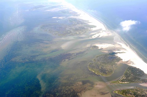
Stunning Chandeleur island photos by Stewart Long today

Stewart Long, grassroots mapper captures stunning chandeleur imagery,  map coming soon.
UPDATE: Here are some notes from Stewart Long about his flight:
“The Pilot reported that the restricted airspace is located below 30 degrees north latitude, and under 3,000′. Not sure what is determining the restrictions, but on Friday we were told that the minimum was 4,000′. Visibility was pretty good. The pilot was flying VFR, […]

Stewart Long, grassroots mapper captures stunning chandeleur imagery,  map coming soon.

UPDATE: Here are some notes from Stewart Long about his flight:

“The Pilot reported that the restricted airspace is located below 30 degrees north latitude, and under 3,000′. Not sure what is determining the restrictions, but on Friday we were told that the minimum was 4,000′. Visibility was pretty good. The pilot was flying VFR, and we did not encounter any other aircraft during the flight visually, or with his instruments. We did not see any booms, and only one or two boats. Lakefront airfield was pretty quiet as well. The pilot reported that the oil in the water look redder the previous day, not sure what that indicates, if anything.”

Visit to Waveland beach, Mississippi

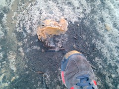
orange putty-like substance at wavelandToo much wind at Waveland today to fly our balloon, and we didn’t have a kite on hand. Can anyone donate big kites like the Sutton Flowform 16? Anyone do KAP and willing to come map with us? Contact the mailing list please!
On foot we found some weird stuff, some certainly petroleum… iridescent and leaving […]

Too much wind at Waveland today to fly our balloon, and we didn’t have a kite on hand. Can anyone donate big kites like the Sutton Flowform 16? Anyone do KAP and willing to come map with us? Contact the mailing list please!

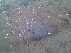
On foot we found some weird stuff, some certainly petroleum… iridescent and leaving orange streaks. Other stuff was a kind of putty of orange claylike substance which was washed up with the orange streaks. Could this be oil all the way over at Waveland? It’s the same color as the stuff the mainstream press is photographing.

orange putty-like substance at wavelandiridescent stuff at waveland beach

Balloon/kite mapping at Lafourche Port, teaching mappers at LA Bucket Brigade

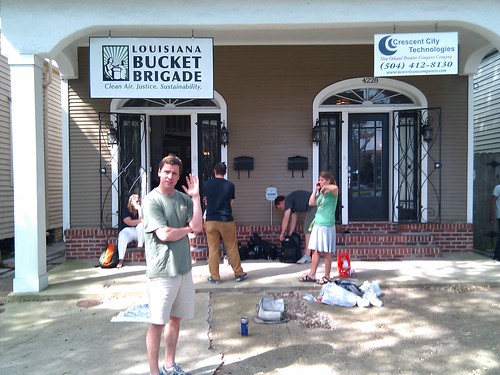
At LABB organizing with volunteersA bit of an update – on Thursday we went down to Grand Isle and met up with folks from Priority5 and the Greater Lafourche Port Commission who fed us delicious food and managed to get us out on a boat near sunset. We focused on testing the theory (suggested on the mailing list at […]

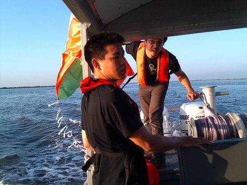
A bit of an update – on Thursday we went down to Grand Isle and met up with folks from Priority5 and the Greater Lafourche Port Commission who fed us delicious food and managed to get us out on a boat near sunset. We focused on testing the theory (suggested on the mailing list at some point) that we could tow a kite even in low winds… and amazingly it worked. The light was failing however and we did not get a lot of imagery. That stuff was posted this morning (gosh it seems like a million years ago).

At LABB organizing with volunteers

We met this morning with a whole lot of volunteers (want to volunteer?) at the LA Bucket Brigade to plan a teaching strategy to increase the number of mappers and to make sure local folks were able to do balloon/kite mapping.

Morning planning

Tomorrow, we’re conducting a training session:

May 8 Training Session

10:00AM This Saturday we are meeting at City Park, New Orleans. Meet on the Southeast side of the Art Museum, look for us out on the lawn. The session will examine the field mapping setup, and how to train others to follow the same model. Come out to see how it is done, and learn how to do it yourself. Google Map link to City Park:

City Park, art museum map

The focus is not on signing up a zillion people (yet!), but in finding local potential mapping leaders, who can organize teams of volunteers to go out to beaches and coasts to map the spill. We’ll try to schedule a mapping trip for you in the next day or two so you’ll have the experience to bring others out as well.

Kite towing tests at Grand Isle

Launching a kite from a small boatHi, all – just posting some quick photos from our tests yesterday; i’ll post text ASAP, but just want to get these out there!
If anyone has a boat to get to Chandeleur, please contact me at 415 508 6769 or email the mailing list!

An example of the kind of imagery we want to be taking, […]

Hi, all – just posting some quick photos from our tests yesterday; i’ll post text ASAP, but just want to get these out there!

If anyone has a boat to get to Chandeleur, please contact me at 415 508 6769 or email the mailing list!

Launching a kite from a small boat

Kite towing test photos

An example of the kind of imagery we want to be taking, albeit in better light:

Coastline, low light

More pictures on Flickr (I’ll post links to full res soon but you have to be a Flickr member for now)

Grassroots Mapping the Gulf Oil Spill

Hi, all – Oliver Yeh and I are down in New Orleans now trying to meet up with local organizers to begin an independent, grassroots ground-truthing/mapping of the spill.
To be clear – we’re not trying to duplicate the satellite imagery or the flyover data (though we’re helping to coordinate some of the flyovers and […]

Hi, all – Oliver Yeh and I are down in New Orleans now trying to meet up with local organizers to begin an independent, grassroots ground-truthing/mapping of the spill.

To be clear – we’re not trying to duplicate the satellite imagery or the flyover data (though we’re helping to coordinate some of the flyovers and trying to make sure the data is publicly accessible). We believe it’s possible for citizens to use balloons, kites, and other simple and inexpensive tools to produce their own documentation of the spill… and that such imagery will be essential for environmental and legal reasons in coming years.

To learn more, check out our organization page in the Grassroots Mapping wiki.

Please, if you’re involved in the response, and live near the spill, call me at 415 508 6769, email me at warren@mit.edu, and tell us where to come to help you document what’s going on!

To join in the discussion or make contact with us, the mailing list is a great place to start.

Map of the Microdot: a micronation at MIT


Sam Kronick (read his awesome page, esp. pictures at the bottom) created a micro-nation called the Microdot on the MIT campus, on the large circle of grass known to students there as ‘the Dot’. He briefly seceded from the US (or MIT, I wasn’t sure), and we managed to make a map of the tiny […]

Sam Kronick (read his awesome page, esp. pictures at the bottom) created a micro-nation called the Microdot on the MIT campus, on the large circle of grass known to students there as ‘the Dot’. He briefly seceded from the US (or MIT, I wasn’t sure), and we managed to make a map of the tiny nation late on its second and last day of existence.

Grassroots balloon mapping is a great way to capture temporary events and document brief invasions of public space… even protests, as we did in the West Bank last December.

See more pictures of the Microdot on Flickr

View the map in Cartagen Knitter

NuVu student project presentations

NuVu student presentations
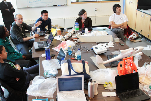
Jean-Babtiste Labrune and Oliver Yeh joined us for the final day of the NuVu Studio workshop on grassroots mapping, where all the students presented their work and we had some good discussion – both about mapping techniques and on a conceptual level. JB spoke a bit about DIY culture and Oliver showed some of his […]

NuVu student presentations

Jean-Babtiste Labrune and Oliver Yeh joined us for the final day of the NuVu Studio workshop on grassroots mapping, where all the students presented their work and we had some good discussion – both about mapping techniques and on a conceptual level. JB spoke a bit about DIY culture and Oliver showed some of his high-altitude ballooning work.

This was a great chance for students to push some of our Advanced Projects forward, and has built on previous work such as the Kite Balloon prototype we built during WhereCamp 2010.

Vanessa on aerodynamic balloons
Mariah on hot air balloons
Hayley on RC airplane mapping
Danielle on helium-filled kites
Julian on mapping Skyline Park in Chestnut Hill

A BCDS math teacher named Rob also joined us and provided some valuable criticism and hand gestures (CC-SA by jeanbabtisteparis):

More kite-balloon photos


Saeed has posted new photos of our balloon flight last week on the NuVu Studio blog.
Today we’re flying the RC plane; photos will be posted ASAP, assuming we successfully fly.

Saeed has posted new photos of our balloon flight last week on the NuVu Studio blog.

Today we’re flying the RC plane; photos will be posted ASAP, assuming we successfully fly.

NuVu/Grassroots Mapping workshop featured in Brookline Tab Blog


Last Thursday in the NuVu Studio workshop, we flew an experimental aerodynamic balloon modeled after a shark’s body at Skyline Park, a former landfill which has been converted to playing fields. A Brookline TAB photographer caught us launching (see above photo) and we made it into their blog:
full (short) article at the Brookline Tab Blog
I […]

Last Thursday in the NuVu Studio workshop, we flew an experimental aerodynamic balloon modeled after a shark’s body at Skyline Park, a former landfill which has been converted to playing fields. A Brookline TAB photographer caught us launching (see above photo) and we made it into their blog:

full (short) article at the Brookline Tab Blog

I mentioned this on the mailing list, but we subsequently lost the balloon due to a bad knot (my fault!). This is our first balloon lost! We’ll be more careful with knots from here on out — apologies to Vanessa and Julian, who built the balloon!