Use Google satellite imagery to rectify on Map Warper
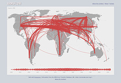
I’ve been taking very high-res imagery from a weather balloon and rectifying it, but the OpenStreetMap data isn’t detailed enough to find rectifying points… the result is a bit like this:

To add a Google layer, just run:
to_map.addLayer(googleSat,{'maxZoomLevel':22});
or drag this bookmarklet into your browser bookmarks bar, and click the bookmark when you’re on the Rectify page:
The result is something like this:

Tags: kibera


November 13th, 2009 at 12:04 am
That first photo is kind of astonishingly amazing.
November 25th, 2009 at 6:18 am
where’d you get that kibera image?
November 25th, 2009 at 9:25 am
Hi Mikel – how’s it going in kibera? The image is by JR: http://jr.blogs.liberation.fr/
but they’re not yet in Google’s satellite imagery, 10+ months later:
Link to Google Maps
November 26th, 2009 at 8:19 pm
The Google imagery seems to be acquired from at least before March 2006, based on comparing features in our Kibera imagery archive [http://aerial.maps.jsintl.org/layers/ -- just experimenting at the moment]
This artwork is one of my favorites, I use it in all my presentations, and it’s just down the hill from where we meet every day.